
Trace a Los Altos Street by Address
A reliable street directory search starts with one complete address and ends with a record chain. First decide whether the question concerns the parcel, a title holder, a city project, or a past occupant. The assessor and GIS can locate land. The recorder can connect an instrument to grantor and grantee roles. Permits can document work at an address. Historical directories and newspapers can add an occupant clue. None of those layers should be read as a complete household roster.
Use the physical city, not just the postal city, because Los Altos mailing territory reaches Los Altos Hills and unincorporated areas. Keep the APN, document number, date, and legal description in separate notes. That practice makes a later street comparison much safer than copying a name from one result and assuming it belongs to every record with the same address.
- Validate the complete address with USPS address and ZIP lookup, then confirm incorporated jurisdiction in the Los Altos Public GIS Viewer.
- Run the address in the Santa Clara County Real Property Search. Record the physical city, APN, latest document number, transfer date, assessed values, exemptions, and districts.
- Open the same parcel in the city viewer and, when the street crosses the city edge, in SCCMap. Click adjoining parcels one at a time and save their APNs.
- Take the latest instrument number or APN to the Clerk-Recorder office. Read the grantor, grantee, recording date, document type, and legal description, then search the seller as an earlier grantee.
- Check Los Altos permit and inspection records by project or address. Request an older plan, permit history, or code record through the city when the dashboard does not expose it.
- For a historical occupant, ask the library or museum about verified reverse directories, yearbooks, Town Crier material, census records, and local-history files. Treat a missing volume entry as an unresolved gap.
The result is a layered street directory: parcel first, title second, municipal work third, and historical household evidence last. A deed identifies an ownership role, not every person who used the address.
Los Altos Street Directory Records
Address-keyed records in Los Altos are distributed among county, city, election, library, and museum systems. The coverage table shows what each record can actually reveal. The assessor web result is free but suppresses the owner. Recorder research is not address-indexed. Voter information is not publicly browsable by street. Historical reverse directories may exist, but the exact local annual run still needs shelf verification.
| Record set | Keeper | What it shows | Access |
|---|---|---|---|
| Assessor property roll | Santa Clara County Assessor | APN, latest instrument, values, exemptions, districts | Free address/APN search; owner suppressed online |
| Assessor owner file | Santa Clara County Assessor | Assessee and mailing address at the office | Public terminal or microfiche |
| City and county GIS | Los Altos and Santa Clara County | Parcel geometry, jurisdiction, zoning, layers, adjacent parcels | Free map browse and click |
| Deeds, liens, and maps | County Clerk-Recorder | Grantor, grantee, instrument, recording date, legal description | Office index and images; copies by known locator |
| Permits and code records | City of Los Altos | Project, work, applicant, contractor, inspections, case status | eTRAKiT, counter, phone, email, or CPRA request |
| Voter records | Santa Clara Registrar of Voters | An exact voter's own status response; qualified file fields | Identity self-lookup or approved purpose only |
| Reverse directories | Library, museum, or historical repository | Historic street, house number, occupant, or phone when held | Ask staff; exact Los Altos run unverified |
The chain is strongest when a parcel number ties the assessor result to the recorder instrument and the GIS map. The street name alone cannot do that work. A mailing address may belong to a title holder away from the parcel, while a permit applicant or contractor may have no residence connection at all.
Note: A public address record may describe land, a project, or a filing party without identifying the people who currently share the address.
Los Altos Assessor Fields for Street Search
The assessor is the main modern street-directory entry point because it accepts an address and returns an APN. It does not provide an owner-name search. Use Advanced Address Search when a street needs to be walked unit by unit, and select the physical city rather than the postal city. The terms checkbox must be accepted before any search runs.
The Santa Clara County assessor search tips explain the field formats and the physical-city warning used for Los Altos. The page distinguishes simple address, advanced address, and APN modes.
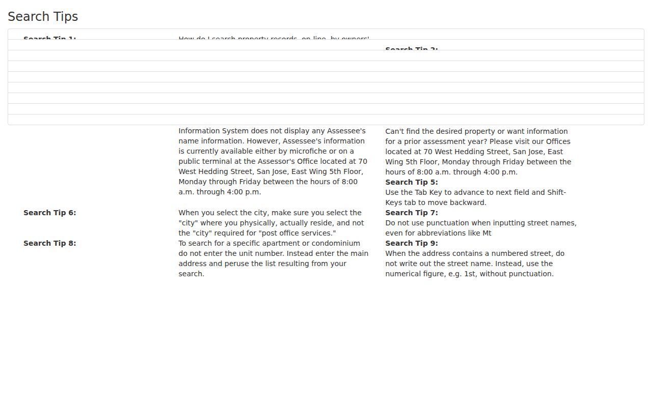
The assessor image gives the field context for a by-address search. It also helps prevent a postal city from sending a parcel request to the wrong jurisdiction.
| Field label | Mode | Required | Format or note |
|---|---|---|---|
| Property address | Simple | Yes | Terms acceptance is required. |
| Street Number | Advanced | Conditional | Use with street name and physical city. |
| Street Direction | Advanced | No | Dropdown. |
| Street Name | Advanced | Yes | At least one character with physical city. |
| Street Type | Advanced | No | Dropdown. |
| Unit | Advanced | No | Leave blank to browse returned units. |
| City | Advanced | Yes | Select physical, not postal, city. |
| APN Number | APN mode | Yes | Eight digits or 123-45-678. |
| Terms acceptance | All modes | Yes | Search button stays disabled until accepted. |
Save the latest document number, document type, and transfer date before leaving the result. The web result can also show land, improvement, and total assessed values, exemptions, net assessed value, tax-rate area, school districts, and other special districts. It does not show the owner or assessee, mailing address, sketch, market sale price, or linked deed image in the basic result.
For an owner-file question, the public terminal or microfiche at the Assessor office is the documented fallback. A Map and Property Characteristics Request form asks for APN or property address, owner name if known, requester contact details, and the desired product. Its located PDF states $6 per item plus a $5 service charge, but the filename is dated 2016, so confirm the live fee before mailing.
Click Adjacent Los Altos Parcels in GIS
The Los Altos Public GIS Viewer accepts an address, an undashed APN, a place, or a point of interest. Locate the seed parcel, zoom until parcel lines remain clear, and click each neighboring parcel separately. The city viewer includes parcel data, zoning and land use, historical designation, and tentative FEMA flood information. Adopted maps control if the viewer conflicts with an official zoning document.
For a wider street, compare the city viewer with SCCMap. County mapping supplies broader geography, parcel reports, layer metadata, nearby points of interest, measurement, markup, and spatial-analysis tutorials. A formal select-all-neighbors or buffer control was not verified. The dependable method is still seed address, visible parcel layer, one click, one APN, and one saved note.
The Los Altos city GIS instructions are the best starting point for a street-browse pass.
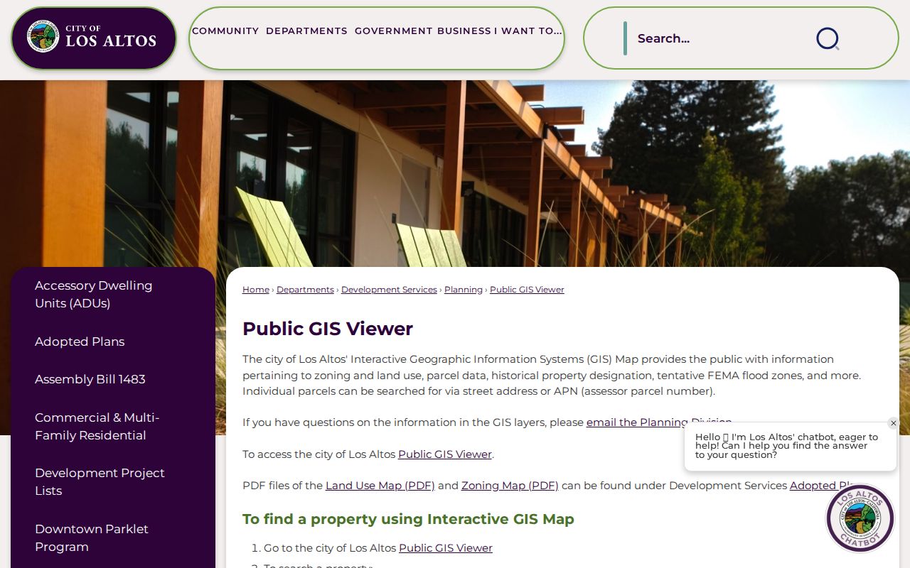
The GIS image shows why adjacent-parcel research is a map task rather than a single resident search. It identifies geometry and layers, not a published household roster.
Record the visible layer date or metadata when possible. Parcel boundaries, districts, and jurisdiction can change, and a postal edge near 94022 or 94024 may cross into Los Altos Hills or unincorporated territory.
Los Altos Recorder Address Limits
The Santa Clara County Official Record Index has been offline since November 5, 2018. The Clerk-Recorder's office supplies the fallback: public workstations cover 1981 forward, while Digital Reel, older books, and microfilm cover 1850 through 1980. Search modes include document number, document date, document class, APN, grantor only, grantee only, and combined grantor/grantee. An address is not an indexed search field, and staff do not conduct title searches.
That limitation changes the street directory method. The assessor supplies the APN or latest title-changing instrument. The recorder then supplies the names and legal description inside the instrument. To move backward, search the seller as an earlier grantee and follow the chain. If a document predates May 1, 1995, book and page can be used for copies; otherwise a document number is the practical locator.
Plain or certified copies can be ordered in person or by mail when the locator is known. The county states $4 for the first page, $2 for each added page, and $2 for certification per document. Data products can provide grantor or grantee rows by document number, date, and type, but they do not turn an office-only system into an address search.
Keep the index row, the deed image, and the legal description as separate evidence. A grantor or grantee is a role in a recorded instrument, not automatic proof of present occupancy.
Los Altos Street Directory Permit Files
Los Altos eTRAKiT handles selected simple permits, project tracking, payments, and inspection scheduling or results. An account is created by email, then a permit, project, or license is linked by number. Permits issued before February 11, 2019 use the project number plus submission year for inspection scheduling. Current plans are electronic, while older plans and address histories may need a city request.
The Los Altos eTRAKiT portal is the first online permit channel for a street record.
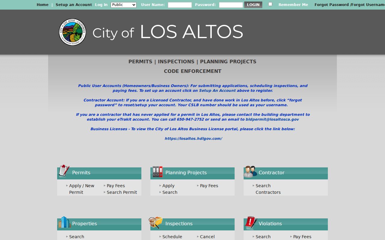
The eTRAKiT image marks the electronic project trail, but an account or linked record may be needed before dashboard details appear.
When a dashboard stops short, request an identifiable permit number or address, date span, and document type through the Los Altos CPRA process. The city can determine disclosure within ten calendar days and may issue a written extension of up to fourteen days for unusual circumstances. Inspection is free, while copies can cost direct duplication expense. Requests can also be directed by telephone, email, or in person to Building, Planning, Code Enforcement, or the City Clerk.
The Los Altos prior public-record request logs provide a local view of address-keyed permit and code-record questions.
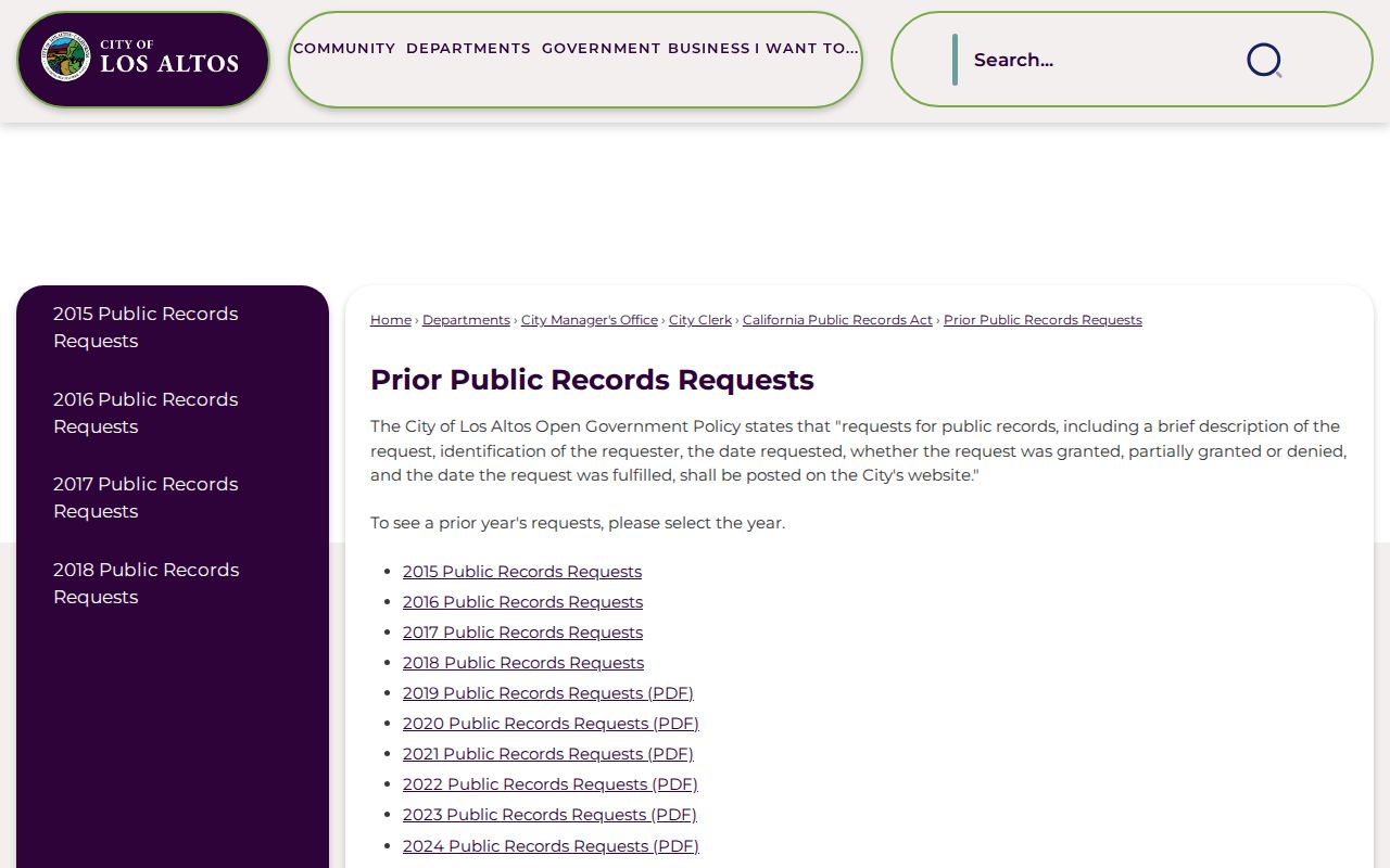
The request-log image shows why an address, date span, and record type make a CPRA request easier to route.
The city documents the Building Division counter and permit routes on its Building page.
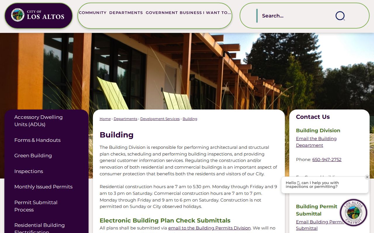
The Building image connects a street address to a municipal project channel without treating a permit applicant or contractor as a household member.
Prior request logs from 2015 through 2024 show that address-specific permit histories, open code lists, plans, and correspondence have been requested. They also show occasions when the city had no record, which is useful evidence rather than a reason to invent a missing file.
Pre-1952 Los Altos Streets Need County Evidence
Los Altos incorporated in 1952, so a house, road, or alteration from the orchard-era settlement can fall between county records and later city permit systems. County deeds, assessment material, legal descriptions, and maps are the durable layer. The city GIS can establish present jurisdiction, but it does not make a pre-incorporation permit appear.
The 1926 and 1932 Sanborn sheets document mapped town buildings and uses, yet rural fringe areas were omitted. A blank map edge is not proof that no structure existed. Los Altos Park was subdivided in December 1925, Loyola Tract dates to 1904, and the Loyola Corners subdivision dates to 1926. Those local dates can help explain why an older address appears under a tract, legal description, or map label instead of a modern street format.
No universal Los Altos street-renumbering year was verified. When a number or name changes, bridge the records with the subdivision plat, APN, legal description, deed chain, and historical map. Do not assume postal continuity from one annual directory to the next.
Note: A pre-incorporation gap usually calls for a county, museum, newspaper, or map search before it calls for a conclusion that no record existed.
Criss-Cross Directories Have a Local Gap
A reverse or criss-cross directory starts with a street and house number, then points toward an occupant or telephone listing. It can be the best historical street tool when a verified volume covers the right year. The Los Altos research, however, did not locate authoritative shelf evidence for a complete Polk or Haines annual run, nor a compliant legible local sample entry. The exact year and publisher must be checked on the volume itself.
Ask the Los Altos Library about yearbooks, vertical files, local newspapers, and licensed genealogy databases. Ask the History Museum about its research library, archives, and Town Crier holdings. The Library of Congress telephone-directory collection can be a further lead, but the exact Los Altos reel years require inspection.
When a reverse volume is found, record the title page, publication date, abbreviation key, alphabetic entry, and matching street entry. Check the pages before and after the address because columns can wrap. Compare adjacent annual volumes and pair the result with the 1940 or 1950 census, Town Crier notices, deeds, probate, or vital evidence.
The historical collection methods are developed on the Los Altos city directories page; the street directory work here remains focused on the address chain.
Los Altos Street Terms for Parcel Work
Street research becomes easier when the record terms are read literally. A parcel is land, a situs is the physical place, and a plat is the recorded map that can preserve a subdivision layout. A reverse directory is a historical address-to-name aid. None of those terms means “everyone who lives here.”
- Parcel
- A mapped unit of land identified by an APN and tied to assessed facts or a legal description.
- Situs address
- The physical address used to locate the parcel. It can differ from a tax mailing address.
- Plat
- A recorded subdivision map that can help bridge old lot, tract, street, and legal-description references.
- Criss-cross directory
- A reverse directory that begins with street and house number and may identify a historic occupant or telephone listing.
Use the same term in each request. Asking the assessor for a situs parcel, the recorder for an indexed instrument, and the city for an existing permit record produces clearer answers than asking one office for a general resident list.
The Los Altos Assessor Owner-Name Myth
The assessor portal's address search can feel like a person search because it returns a parcel, document, and value record. It does not publish the owner or assessee in the basic web result, and it has no public owner-name field. That is intentional. The office terminal or microfiche is the documented route for assessee information, subject to the office's current procedures.
A Homeowner's Exemption may be consistent with owner occupancy, but it does not prove who currently lives at the address. A tax mailing address may identify a title holder who is elsewhere. A permit applicant may be a contractor or project contact. A deed may show a grantee while the household remains unknown. These distinctions keep the street directory from overstating what an assessor result can prove.
When the goal changes from the parcel to one named person, use a separate identity workflow and corroborate case, license, business, or historical facts rather than forcing a name into the assessor search.
An Early Recorder Visit Saves Search Time
The Clerk-Recorder recommends arriving early because a busy public workstation period may be limited to one hour. That practical detail matters for a long Los Altos street or a chain that crosses the 1981 change in search tools. Bring the APN, latest instrument number, physical address, alternate spellings, and any book or page reference already found.
Start with the office mode that matches the date. Use the 1981-forward workstation for newer records, then switch to Digital Reel, books, or microfilm for 1850 through 1980. Search grantor and grantee roles separately, write down each document number and date, and preserve legal-description language before moving to the next deed.
Order a copy only after the locator is known. A data subscription or published dataset can help with a known document number, but neither replaces the office search when the only clue is a street address.
Los Altos Street Directory Privacy
No official Los Altos tool returns every person on a street. The voter form is an exact self-lookup, not a block browse. DMV personal data is restricted by the DPPA and California vehicle law. Utility customers, minors, protected residents, and household structure are not open street-directory fields. GIS shows adjacent geometry, while the assessor web result shows parcel facts. Neither supplies a private resident roster.
A lawful street search can support property history, family research, civic records, or a careful effort to reconnect. It should stop when the next step would expose a protected address or turn a public record into a synthesized profile. When one person must be verified, the Los Altos resident lookup workflow keeps the question tied to independent record custodians.
Lawful personal use. Use Los Altos street and address records for legitimate personal or historical research. Do not use them to stalk, harass, intimidate, or harm anyone, and do not treat a parcel trail as permission to contact a private household.
Note: A missing public result can reflect a legal privacy limit, an office-only index, a pre-1952 date, or a record that was never created.